About Thomas Hauth

I work on AR/VR systems and visual robotic navigation and I am always looking for a peek around the next corner of technology.

How to Connect an LP-Research IMU to ROS (Update)

Introduction

This article describes how to connect an LP-RESEARCH inertial measurement unit (IMU) using a Robot Operating System (ROS) node. We are happy to announce that our IMU ROS sensor driver has been accepted into the official ROS package repository. The Robot Operating System, or ROS in short, is an open-source de-facto standard for robotics sensing and control.

With the package openzen_sensor now provided as part of the ROS distribution Melodic Morenia it just became a whole lot easier to use our sensors in robotic applications.

Note: This article covers our node for ROS 1. Please see further information regarding our ROS 2 node at the end of this article. This post is a follow-up to our previous ROS driver release.

Published ROS Topics

These are the ROS topics which are published by the OpenZen ROS driver:

Message

Type

Description

/imu/data

Inertial data from the IMU. Includes calibrated acceleration, calibrated angular rates and orientation. The orientation is always unit quaternion.

/imu/mag

Magnetometer reading from the sensor.

/imu/nav

Global position from a satellite navigation system. Only available if the IMU includes a GNSS chip.

/imu/is_autocalibration_active

Latched topic indicating if the gyro autocalibration feature is active.

Installation of the LPMS ROS Driver

All that’s needed is to install the package openzen_sensor via your Linux distribution’s package manager. In Ubuntu, with the ROS Melodic Morenia distribution installed, use the following command:

Once the IMU ROS driver package is installed, we use the following command to start the OpenZen node:

This will automatically connect to the first available IMU and start streaming its accelerometer, gyroscope and magnetometer data to ROS. If your sensor is equipped with a GPS unit, global positioning information will also be transferred to ROS.

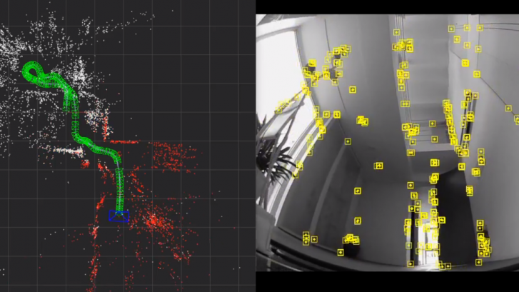
Once a sensor has been connected via the motion sensor driver, the data from the sensor is exported via ROS topics which can be consumed by other ROS components such as a navigation and path planning system.

Outputting IMU sensor values on the command line can now be easily done with:

and the data can be plotted with:

More information on the usage of the OpenZen IMU ROS driver can be found in the repository of the driver.

The image above shows an angular velocity output graph in the ROS MatPlot application from an LPMS-IG1 sensor.

ROS 2 Release

We have recently released a ROS 2 version of our OpenZEN ROS node. The node is not part of an official ROS2 release yet, but it works well on the latest release Foxy. For surther information and source code see the OpenZenROS2 repository.

LPNAV – Outdoor Operation and 2D Map Building for Automatic Guided Vehicles (AGV)

LPNAV for Flexible, Rapid AGV Deployment

LPNAV enables automatic guided vehicles (AGV) to rapidly understand their environment and be ready for safe and efficient operation; no calibration, manual map building etc. is required.

With the help of LPNAV, mobile logistics platforms can operate (localize) in both, indoor and outdoor environments with the same set of sensors (Figure 1) and a unified map, e.g. when transporting an item from inside a warehouse to a truck parked in front of the warehouse. This offers a big cost-saving potential for applications in which so far the transition from indoor to outdoor settings required specialized equipment or manual handling.

Outdoor Localization

In a previous post we have shown the capability of LPNAV to operate in a small, crowded indoor environment. After further optimization of the algorithm we are now able to show the system working well in outdoor settings. Uncontrolled outdoor environments are particularly challenging as lighting conditions can vary very strongly and perception can be disturbed by pedestrians, passing cars etc.

In the video above we show the following capabilities of the system:

  • LPNAV is able to build a 3D map of its environment and localizes itself in real-time relative to its starting position.
  • Previously acquired map data can be used for localization. The map is automatically updated to environment changes.
  • When manually placed at a deliberate location on the map, an LPNAV-powered robot can instantly re-localize.
  • The system is robust to camera occlusions. Sensor fusion with IMU and odometry allows temporary operation without visual features.

Figure 1 – LPNAV combines information from visual SLAM (camera), inertial measurement unit (IMU), distance sensors (lidar, IR) and wheel encoder data to calculate low-latency, high-accuracy localization results. The robot maps its environment to both, a 3D point cloud map and a human-readable 2D obstacle map.

2D Real-time Map Building

The 3D point-cloud maps built by LPNAV’s visual SLAM work well for computational localization of the robot inside its environment, but they are hard to intuitively understand by humans. Therefore we added a feature to LPNAV that allows building 2D maps of the robot environment based on information from its IR distance sensors. To achieve 2D wall / obstacle mapping at larger distances, alternatively to the IR sensors a 2D Lidar can be used.

The 2D real-time mapping capability is demonstrated in the video below:

LPNAV-VAC – Cost-Efficient Navigation System for AGVs

Introduction

We’re proud to announce a breakthrough result in the development of our LPNAV low-cost navigation system for small-sized automatic guided vehicles (AGV).

One focus area of LPNAV are vacuum cleaning robots that require spatial understanding of their environment to calculate an optimum cleaning strategy. As vacuum cleaning robots are mainly consumer devices, solutions for this market need to be cost-efficient, while maintaining state-of-the-art performance.

Figure 1 – The LPNAV-VAC development kit contains a robot platform, a dedicated computing unit, an IMU sensor and a camera

Development Platform

LPNAV-VAC combines three different data sources in order to calculate a robot’s position inside a room: an inertial measurement unit, data from the robot’s wheel encoders and video images from a camera installed on the robot (Figure 1). A central computing unit combines the information from these data sources to simultaneously create a map of the surroundings of the robot and calculate the position of the robot inside the room.

It is essential that sensor fusion algorithm is able to dynamically update the map it is constructing. As new sensor information arrives the map is continuously adapted to reflect an optimized view the robot’s environment.

While this principle of simultaneous localization and mapping (SLAM) is an established method for some robot navigation systems, these solutions tend to rely on laser scanners (LIDAR) or vision-only reconstruction. The combination of all available data sources in the robot allows LPNAV-VAC to create high definition maps of the environment while using low-cost, off-the-shelf components.

First Demonstration

In the demonstration video above my colleague and main developer of LPNAV-VAC is steering our AGV platform through the ground floor of our Tokyo office. While the right side of the screen shows the view from the robot camera and detected visual features, the right side shows the path of the robot through the environment. As the robot progresses through the room a 3D map is created and continuously updated.

Please note that the robot doesn’t lose tracking during turns, while driving over small steps in the room or with changing environment lighting. Also Thomas moving around in front of the camera doesn’t disturb the LPNAV algorithm.

Using this map and the robot’s position information a path planning algorithm can find an optimum path for the robot to efficiently clean the room.

OpenZen 1.0 Release

Going Full Circle for Sensor Data Streaming with OpenZen

Since the foundation of LP-Research, it is not only important for us to provide excellent hardware to our customers but we also want to provide software components which ease the adoption and usage of our products. Over the years, we have provided various libraries to support customers using our sensor hardware on a diverse set of platforms.

As our range of sensor offerings is growing, we realized that we need to consolidate our software library stack while still supporting multiple platforms. We wanted to use this opportunity to create a more modular system to work with sensors with various measurement components.

Figure 1 – OpenZen Unity plugin connected to a LPMS-CU2 sensor and live visualization of sensor orientation.

Based on theses requirements, we developed OpenZen. It is our take on a high performance sensor data streaming and processing library. It combines our experience gained during mopre thant five years of sensor data processing with modern software techniques. The core of OpenZen is developed with the modern C++14 language. We are hosting the source code in an open source repository for seamless public domain access to learn and contribute to the code base.

Core Concept

One basic principle of OpenZen is to abstract the sensor components provided by a sensor from the transport layer of the communication. In this way, once the user is familiar with the OpenZen API, a wide range of sensor types via various connection layers can be used. To reach the lowest latency and the highest sensor data throughput, we designed OpenZen to be fully event-based and without any polling loops which could introduce delays.

Sensor Types and Connectivity

With release 1.0, OpenZen provides a sensor interface for the measurements of inertial-measurement units (IMU) and the output of global navigation satellite systems (GNSS). For example, our new LPMS-IG1P sensor is a combined IMU and GNSS-unit. Both units can be read-out via OpenZen.

A list of supported sensors is here.

OpenZen supports sensor connections via various interfaces like USB, serial port, CAN-Bus and Bluetooth. Furthermore, measurement data from sensors can also be streamed via a network and received on a second system by an OpenZen instance.

A list of supported transport layers is here.

Operating Systems and Programming Languages

Currently, OpenZen can be compiled and used on Windows, Linux and MacOS systems. We are working on ports to more platforms, for example Android. Due to its modular design, the OpenZen API can be accessed from many programming languages. At this time, we support the C, C++ and C# programming languages and we provide a ready-to-go Unity plugin.